Showing posts with label NZ Walks. Show all posts

Tuesday, 20 February 2018

Wandered Down to Whangaruru ….. January 2018

12 – 14 Jan:  Tuparehua Bay, Whangaruru ~ 35 21S 174 20E

P1112480From Mumu to Ruru

After a couple of sunny days and peaceful nights anchored in Whangamumu we left in company with French Curve to move 16 miles further south.  Two sail boats – same length, going the same way, yep it was race on.  Conditions were glorious for a light air downwind run, nothing too strenuous today. 

Whangaruru is a large harbour with a choice of several anchorages offering shelter from most wind angles.  P1122483We nestled in close to the harbour side of Bland Bay a popular spot for Kiwis camping for their summer holidays as there is the protected harbour beach and on the other side of the sliver of an isthmus is the ocean.   Just perfect. 

14 years ago when we came this way in Balvenie conditions were perfect for anchoring in Bland Bay and we dinghied ashore and met up with friends camping there, now it was time to see it from the other side.

We had originally thought we would spend a few days here exploring but with a change of weather on the horizon we changed plans and just stayed 2 nights.

Worthwhile Walk ….. Whangaruru North Head Loop (about 8 kms, leisurely 3 hours from memory, shorter option down from top, elevation about 180 metres)

P1122489P1122491

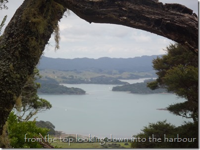
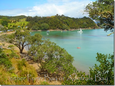
We took the dinghy ashore to the beach on the right of the little island - Sandy Bay?, there were private homes and some campers and we asked to walk through one property to join the gravel road behind.  P1122490Turn right and you can see the sealed where you go right again and after a short time there was a big DOC sign on the left (hidden behind long grasses and easy to miss).  It was a gradual climb initially through grasslands then up into native bush with a few spots for admiring the view.  More steeply uphill to the ridge with a sign on it showing a track directly downhill on the right for a shorter option.  We carried on, passing remote coves then the trail crosses back to the harbour side, through some farmland and past some buildings that are an Outdoors Camp.  P1122495Then we followed a dirt track that went inland and took us along to the bay in the adjacent photo, the sun came out, campers were in swimming, kayakers were paddling, a very Kiwi summer scene.  There is a camp ground there (toilets and water), walk through it and you will find another DOC track to the next beach north, then there was an unmarked but wide trail inland about 100m which joined the road.  Turn left and straight forward along here back to the dinghy, not very far.

  P1122487

Still More Whanga’s To Come

Wednesday, 31 January 2018

Which Way are all the Whanga’s? ….. Jan 2018

10 – 12 Jan 2018:  Whangamumu ~ 35 15S  174 17E

P1092449

Farewell to the Bay of Islands

IMG_20180110_141212When we arrived from the tropics to Opua late November 2016 never in our wildest dreams did we think it would be 14 months before we would start our journey south to Auckland.  But as we all know life has a way of throwing the unexpected when least expected, so here we were a year later than planned, finally homeward bound.  IMG_20180110_142347

We sailed out of the Kerikeri Inlet on another stunner of a summers day, a light breeze filled the sails and skipper pointed for Cape Brett.  The Bay was buzzing with life - yachts under full sail heading in all directions, fishing boats big and small hunting for the catch of the day and tour boats aplenty doing the Dolphin Spotting and Hole in the Rock cruises.  IMG_20180110_142622

You could not have asked for a more perfect day to slip across the head of bay, then “Shoot Piercy”, just one of those things all coastal sailors around these parts like to do when conditions allow.  Its the small and often very lively little gap between the Hole in the Rock and Cape Brett, today it was flat calm and we shot on through.

 P1102462P1102461

First of 3 “Whanga’s”

Sailing into Whangamumu was like discovering a hidden gem,P1102457 the outer harbour is an acceptable anchorage in its own right but as you continue a inner sanctum unfolds and what a top spot.  It looks quite small on the chart but by sunset we had very close to 50 vessels of all shapes and sizes and we had room for a few more.

We rendezvoused with our American friends on French Curve, and were thrilled to have quick catch ups with Savarna, we last saw Keith and Pam in the US Virgin Islands and also Paul now on his new yacht Matariki, we did the Auckland to Fiji Rally in 2004 with Paul and his family on his previous yacht Montego Bay and hadn’t seen them since.IMG_20180111_132857
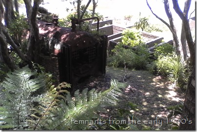
The fabulous run of weather continued the following day and after a great cooked breakfast on Matariki we ventured ashore to explore the ruins of the old whaling station.  Back in the early 1900’s whalers would set nets out from the coastline to Net Rock to trap or slow down the humpback whales then go out in their boat to harpoon them.  They were then dragged into the harbour and processed.  According to records over 70 whales were trapped in 1927.

IMG_20180111_142435 IMG_20180111_131854_3

Worthwhile Walk …..  From Whaling Station to Waterfall/Scenic Lookout

Dinghy ashore to the little beach where you can see the ruined jetty and whaling station.  Its easy to find the track up to the waterfall, its about 10 mins each way and there are a couple of small pools that you can have a dip in.   IMG_20180111_150104 Return to the beach and head behind the ruins on the path and soon there is a sign indicating left inland to Rawhiti  or straight ahead up to Cape Brett.  We took the Cape Brett path, it was quite a steady steep climb on a well trodden path, mainly in the shade of native bush. It took about 30 mins to reach the lookout at the top, the photos above show the spectacular view.  We returned down to the sign post and took the path to Rawhiti, it follows the coastline to the head of the bay but appeared to be low tide access only.  It looked like you would need to take your dinghy to the beach at the head of bay to access the trail through the grass up the hill inland.  

What’s The Next Whanga?

Tuesday, 13 December 2016

Beautiful Bay of Islands ….. December 2016

05 – 10 December:  Russell & Matauwhi Bay – 35 18S 174 07W

After the Bubbles Settled

The celebrations continued for a few days as more and more yachts arrived into Opua.  This was the light at the end of the tunnel for many boats after a long long passage across the vast Pacific Ocean.  We spent a week in the Bay of Islands Marina washing layers of salt off the outside, cleaning and sorting out the inside of Balvenie.  Laundry was done (ah the joys of washing machines) sim cards were activated, Wi-Fi connections made to reconnect with the world.  Then came the task of restocking the lockers with all our old kiwi favourites and undertaking taste tests to find new ones.  We were back “in the land of stuff”, and didn't our wallets know it.
TIME TO BUY MARK SOME NEW SHORTS!

Historic Russell, Hellhole of the Pacific!

We left the marina after a week and headed off 4 miles back out the Veronica Channel to Russell, gosh I like these little short hops!

This has always been a favourite spot for us to visit, although this was the first time we had arrived on our own boat.  Russell was settled long before Captain Cook arrived in 1769 and thrived as a provisioning stopover, mainly for whaling ships.  It expanded quickly in the early 1800’s and for a time became known as the Hellhole of the Pacific, it once had the most public houses (pubs) in NZ and was the countries first capital.
THE HELL HOLE OF THE PACIFIC IN THE SOFT EVENING LIGHT


The restored historic Duke of Marlborough Hotel has prime position on the waterfront and was issued the first hotel license in New Zealand in 1840.  When the whaling ships left and the capital was relocated to Auckland things quietened down considerably.  Most visitors arrive now as day-trippers by ferry from nearby Paihia and discover a charming compact sleepy seaside town with handsome historic buildings lining the bay.    
We enjoyed a few nights anchored outside the moored boats, the ferry wash during the day does get a little annoying but tolerable, if you want to take a mooring call Russell Radio on VHF63 and they will allocate you one if there is anything available, they take payment too.

New to the Blog ……..  

Worthwhile Walks
GREAT OVERVIEW OF THE BAY FROM THE FLAGPOLE

 We are keen on keeping fit and jumping off the back of Balvenie for a swim and snorkel just isn’t an option until the water warms up considerably.  So for now we will enjoy walking, both for exercise, spotting birdlife and seeing the countryside.  Now that we are home we will share worthwhile walks we enjoy and try to give a few directions so if you want to follow in our footsteps you wont get (too) lost.  Warning though, we do like hills and we walk fast.  The DOC signs I refer to are the yellow and green Department of Conservation ones, they normally indicate times of walks and level of fitness required, sometimes they have a map.

   
From Russell Wharf to Tapeka Pa via Maiki Hill Flagstaff (3hrs – shorter options detailed, good hills) 

From Russell Wharf turn left along the waterfront, past the Duke of Marlborough along road.  Turn right at junction before car park then left straight away and follow the road up the steep hill.  (If you just want to go to the Flagstaff take this road to end then footpath through bush).  On the left there is a marked DOC bush track on the left off the road, it is detailed as alternative route to the Flagstaff, take this downhill to the T junction.  (You can go left here back to Russell only at Low tide).  Turn right up the hill to the road.  Continue up road, another marked track on your left offers a side trip down to a small beach about 10-15mins return. 
VIEWS ENROUTE TO TAPEKA PA
Back on road another 100 metres on right is track up to Flagstaff.  Lovely view, also short track across to Sundial up here, in between these two in the car park is track on right which takes you back to original steep road and Russell.   


To continue to Tapeka Pa retrace steps from Flagstaff down short track to road and turn right then left along main road.  Take care, there is no footpath but it is not a busy road.  Along here a way on the right is a marked private track open to the public, it goes down through the bush and there is a boardwalk through wetlands, it re-joins the road just before Tapeka settlement.  This is a small coastal village with no shops.  Follow road to right then around to left then there is a DOC track sign on left at top of road, some uphilling then levels off, this takes you out to the end of the peninsula for a wonderful view of the islands.  Return same way to Tapeka settlement.  From there is a low tide only walk back to Russell along rocks, we were there at low tide but the track wasn't obvious to us so we  returned via the road to Russell.

Here Comes Summer!!